Yu shan Main Peak Trail
玉山主峰步道
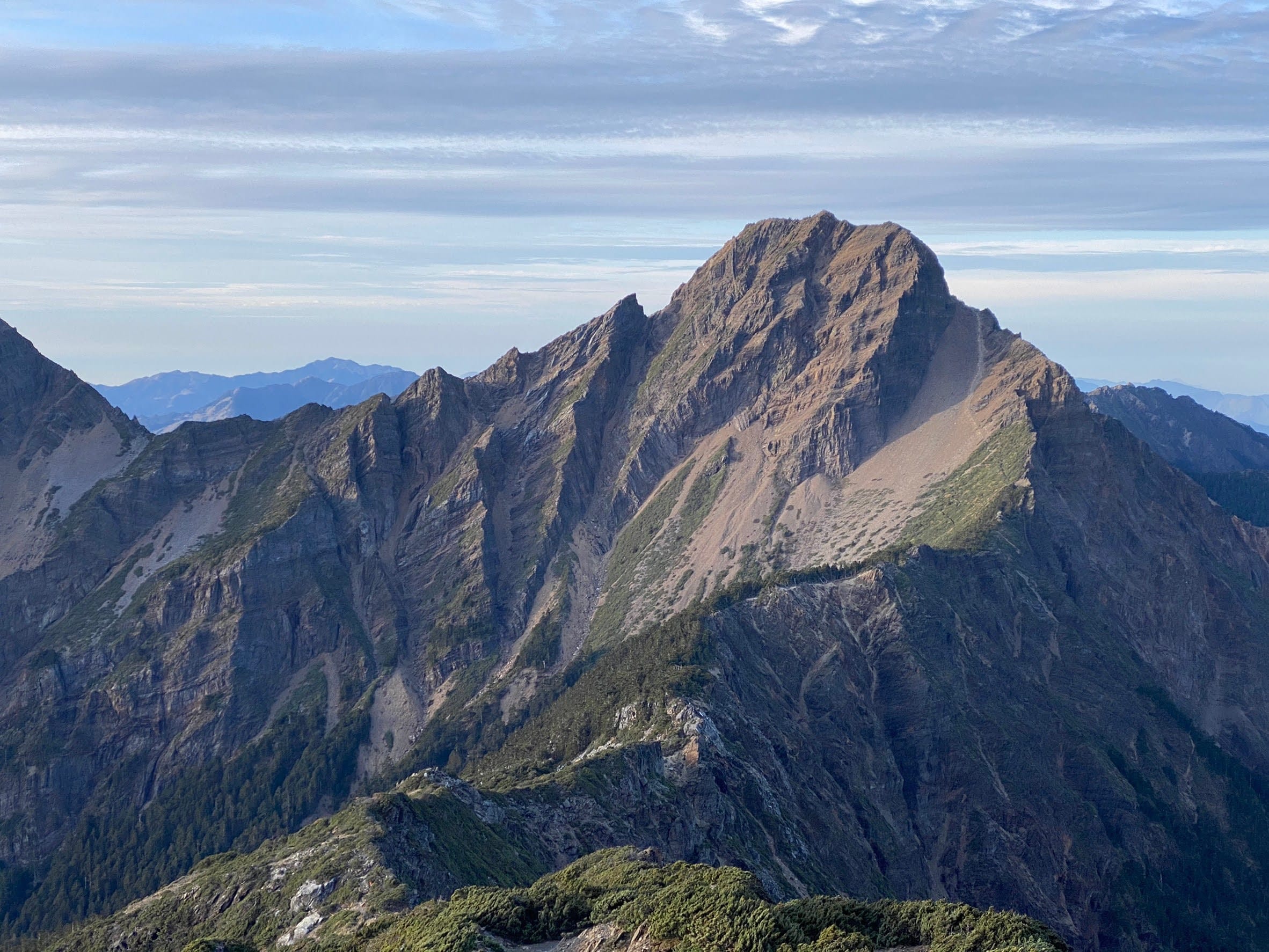
Jade Mountain Main Peak
Mt. Jade Main Peak
About this trail
Yushan Main Peak Trail leads to Taiwan's highest summit at 3,952 meters, offering breathtaking panoramic views, spectacular sunrises, and an unforgettable journey to the highest peak in Northeast Asia
Trail condition
Hands may be needed for balance or climbing on rocks, steep terrain, or fixed ropes.
The route includes exposed ridges, steep drop-offs, cliffs, or similar terrain where a fall could have serious consequences.
The trail is well defined and generally easy to follow.
Getting there
By Public Transport
Trailhead:
You can reach Yushan Trailhead from either Sun Moon Lake (Nantou) or Alishan (Chiayi).
From Sun Moon Lake
1) Go to Sun Moon Lake Bus stop or Xiangshan Administrative Center Bus stop
2) Take Taiwan Tourist Shuttle Bus 6739 (員林客運) toward Alishan and get off at Tataka
From Alishan
1) Go to Alishan Transport Station
2) Take Taiwan Tourist Shuttle Bus 6739 (員林客運) toward Sun Moon Lake and get off at Tataka
Important: Bus 6739 operates only once a day in each direction and requires advance reservation.
Tataka to Yushan Trailhead: A shuttle runs between Shangdongpu Parking Lot and Yushan Trailhead daily from 6:00 a.m. to 5:00 p.m. The fare is NT$150 per person, cash only. No reservation is required; seats are available on a first-come, first-served basis.
By Car
Trailhead:
1) Navigate to Shangdongpu Parking Lot (上東埔停車場) on Google Maps. Limited parking is available.
2) From parking, search for “Yushan Trailhead” on Google Maps and follow the walking directions to the trailhead. The walk is approximately 2.8 km. Shuttle bus is available.
Note: If you are driving from Shuili, Nantou, Provincial Highway 21 between Caopingtou and Tataka, is closed daily from 5:30 p.m. to 7:00 a.m. The road reopens at 7:00 a.m.
History & culture
Name Origin
Yushan has long been revered as a sacred mountain by the Bunun and Tsou peoples. It was renamed Niitaka Mountain during the Japanese era after surpassing Mount Fuji in elevation, before officially regaining the name Yushan in 1947.
Wildlife
Yushan National Park is home to diverse alpine wildlife, including the Formosan black bear, Formosan macaque, sambar deer, and over 135 bird species, making it one of Taiwan's richest mountain ecosystems.
Plants
The trail passes through distinct vegetation zones, from pine, spruce, and fir forests to alpine shrubs and hardy plants such as Yushan rhododendrons and Yushan junipers, which thrive in the harsh high-altitude environment.
Geology & Landscape
Formed by the collision of the Eurasian and Philippine Sea Plates, Yushan features dramatic cliffs, rugged ridges, and steep scree slopes. At 3,952 meters, its towering summit dominates Taiwan's highest mountain range.